Sewer Inspection & GPR Scanning | On The Mark Locators
Underground sewer systems are essential to residential, commercial, and municipal infrastructure. They transport wastewater away from buildings and properties, supporting sanitation, public health, and everyday operations. However, because these systems are buried beneath the ground, identifying their condition and location can be challenging without specialized inspection equipment.
A damaged sewer line, hidden blockage, pipe separation, or unexpected underground connection can create serious problems for property owners and construction professionals. These issues may lead to wastewater backups, costly repairs, excavation complications, and unexpected project delays.
Sewer inspection cameras have become an important tool for investigating underground drainage systems. They allow technicians to examine the inside of accessible pipes without immediately excavating the surrounding ground. However, despite their capabilities, sewer cameras cannot identify every underground problem or locate all buried utilities.
Understanding what different inspection technologies can and cannot detect is essential when planning construction, maintenance, rehabilitation, or excavation work.
This is where professional utility locating becomes equally important. A utility line locator can help identify detectable underground infrastructure, while GPR scanning provides additional information about potential buried objects and non-metallic utilities. For properties with privately owned infrastructure, professional private utility locating services can help uncover underground lines that may not appear in public utility records.
At On The Mark Locators, we use advanced locating technologies and professional expertise to help contractors, engineers, municipalities, and property owners better understand underground conditions before construction begins.
In this guide, we will explore sewer inspection camera capabilities, their limitations, and how combining different underground detection methods can support safer and more informed project decisions.
1. What Is a Sewer Inspection Camera and How Does It Work?
A sewer inspection camera is a specialized piece of equipment designed to examine the interior of underground drainage and sewer pipes.
The system typically consists of a waterproof camera attached to a flexible cable or mounted on a remotely operated crawler. The camera travels through an accessible pipe and transmits live video footage to a monitor, allowing technicians to examine the pipe's internal condition.
Some advanced systems include recording capabilities, distance measurements, and specialized camera heads that provide different viewing angles.
What Happens During a Sewer Camera Inspection?
A typical inspection involves several steps:
Step 1: Accessing the Pipe
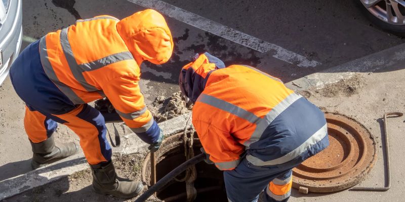
Technicians identify an appropriate access point, such as a cleanout, manhole, or other suitable opening.
Step 2: Inserting the Camera
The camera is carefully introduced into the sewer line and moved through the pipe.
Step 3: Examining Internal Conditions
Live footage allows technicians to identify visible defects, blockages, deposits, and other irregularities.
Step 4: Recording Inspection Findings
Video recordings and inspection notes can document the condition of the pipe and identify areas requiring further investigation.
Step 5: Evaluating Potential Problems
Technicians review the footage to determine whether maintenance, cleaning, repairs, or additional investigation may be necessary.
Sewer camera inspections are particularly useful when property owners or construction professionals need visual information about existing sewer infrastructure without immediately opening the ground.
2. What Can Sewer Cameras Actually Detect?
Sewer inspection cameras provide valuable information about the interior condition of underground pipes. They help technicians identify visible problems that could affect wastewater flow or the structural condition of a sewer system.
Some of the most common findings include:
Cracks and Pipe Damage
Cameras can reveal visible cracks, fractures, and other structural defects inside sewer pipes. Identifying these conditions early may help property owners plan repairs before the damage becomes more extensive.
Blockages and Obstructions
Grease buildup, accumulated debris, tree roots, and foreign objects can restrict wastewater flow. A sewer camera helps identify visible obstructions and determine where further cleaning or maintenance may be required.
Root Intrusion
Tree roots can enter sewer pipes through joints, cracks, or damaged connections. Once inside, they may continue growing and create significant restrictions.
Camera footage can help identify root intrusion and determine the affected section of the pipe.
Pipe Separation and Misaligned Joints
Underground pipes can shift over time because of soil movement, settlement, or installation problems. A camera may reveal separated joints, offsets, and misaligned pipe sections.
Corrosion and Deterioration
Older sewer infrastructure may experience corrosion, surface deterioration, and material degradation. Visual inspection can help technicians identify signs of deterioration that require further evaluation.
Standing Water and Sediment
Unexpected standing water or sediment accumulation may indicate drainage problems, improper pipe slope, or partial blockages.
Although these observations can help identify potential issues, a camera inspection does not automatically establish the complete cause or extent of every defect.
3. What Sewer Cameras Cannot Detect: Understanding Their Limitations
While sewer cameras are useful diagnostic tools, they have limitations that property owners and construction professionals should understand.
The most important limitation is that a sewer camera primarily examines the inside of an accessible pipe. It does not provide a complete picture of everything surrounding that pipe underground.
Here are several important limitations.
Hidden Underground Utilities
A sewer camera cannot independently identify every electrical cable, gas line, water pipe, or communication conduit buried outside the sewer system.
If a construction project involves excavation near existing infrastructure, a separate underground utility locating investigation may be necessary.
Soil Conditions Around the Pipe
A camera can show visible damage inside a pipe, but it cannot fully evaluate the surrounding soil conditions.
For example, a crack may indicate a potential problem, but the camera alone cannot determine whether the surrounding soil has experienced significant erosion or developed an underground void.
Additional investigation may be needed to evaluate the surrounding ground.
Exact Pipe Location Above Ground
Camera footage can provide information about the direction and distance traveled inside a pipe. However, those measurements do not necessarily establish the pipe's exact surface position.
A compatible camera sonde or locating transmitter may help technicians trace the camera's position from above ground when the equipment and conditions allow.
This is particularly important when excavation is planned around an existing sewer line.
Completely Blocked or Collapsed Pipes
If a sewer pipe is completely blocked, severely damaged, or collapsed, the camera may be unable to travel beyond the obstruction.
As a result, technicians may only be able to inspect the accessible section of the system.
Problems Outside the Camera's Field of View
Sharp bends, complex pipe connections, standing water, debris, and limited visibility can restrict what a camera can observe.
A camera also cannot always determine the underlying reason for a visible defect.
Recognizing these limitations helps project teams understand when additional investigation methods are necessary.
4. Why a Utility Line Locator Is Important Beyond Sewer Camera Inspections
Sewer camera inspections focus on the internal condition of drainage infrastructure. However, construction projects frequently involve multiple underground systems that may occupy the same general area.
These can include water lines, electrical conduits, gas pipelines, communication cables, storm drains, and sanitary sewer connections.
A professional utility line locator uses specialized equipment to investigate and trace detectable underground infrastructure before excavation.
Electromagnetic locating is commonly used to identify conductive utilities. Depending on the equipment and site conditions, technicians may use active signals or passive detection techniques.
This can help identify:
Metallic water and sewer infrastructure.
Electrical distribution lines.
Communication cables.
Conductive utility conduits.
Other detectable buried infrastructure.
For example, imagine a contractor planning to install a new drainage connection near an existing sewer line.
A sewer camera may help determine the internal condition of the existing pipe, but it will not independently identify every nearby electrical or communication line.
A professional utility locating investigation provides additional information about potential underground conflicts.
This distinction is important because sewer inspection and utility locating address different questions:
Sewer cameras: What is happening inside the pipe?
Utility locating: Where are detectable underground utilities?
GPR: What additional subsurface features or anomalies may be present?
Using the appropriate method for each investigation can help reduce uncertainty before construction begins.
5. How GPR Scanning Helps Identify Underground Features Beyond Sewer Pipes
Ground Penetrating Radar (GPR) is another valuable technology used to investigate subsurface conditions.
Unlike a sewer camera, which travels through an accessible pipe, GPR equipment scans from the ground surface.
It transmits electromagnetic energy into the subsurface and records reflected signals from buried objects and changes in underground materials.
Trained technicians interpret these signals to identify potential underground features.
What Can GPR Scanning Help Identify?
Depending on the target, soil conditions, depth, and equipment, gpr scanning may help investigate:
Non-metallic underground pipes.
Stormwater drainage infrastructure.
Sanitary sewer lines.
Fiber-optic utility routes.
Buried structures.
Underground anomalies and potential voids.
Changes in subsurface materials.
GPR is particularly valuable when traditional electromagnetic locating methods cannot provide sufficient information about certain underground features.
For example, some plastic or non-metallic pipes may not produce a detectable electromagnetic signal. GPR can provide another method of investigating their potential location.
However, GPR is not a guaranteed detection method for every underground object. Clay-rich soil, moisture, depth, target size, and other site conditions can affect performance.
Professional interpretation and an appropriate scanning approach are therefore essential.
At On The Mark Locators, GPR Utility Locating is part of a multi-technology approach that also includes electromagnetic passive and induction locating.
This helps provide additional underground information when investigating complex project areas.
6. Why Private Utility Locating Services Are Essential for Sewer and Construction Projects
One common misconception among property owners and contractors is that calling 811 identifies every underground utility on a property.
Public one-call locating programs are important for excavation safety, but their coverage generally focuses on participating utility owners' facilities. Privately owned infrastructure may not be included.
This can leave important underground systems unidentified, particularly on commercial, industrial, and large residential properties.
Professional private utility locating services help investigate underground infrastructure that may not be covered by public utility marking programs.
These services can help identify:
Private water service lines.
Underground electrical distribution.
Communication and fiber-optic lines.
Private gas infrastructure.
Sanitary sewer connections.
Storm drainage systems.
Industrial process piping.
Abandoned or undocumented utilities.
How Does This Help With Sewer-Related Projects?
Consider a commercial property preparing for sewer rehabilitation or drainage improvements.
The available utility drawings may show the primary sewer connection but fail to identify other privately installed underground infrastructure.
Excavating without investigating those additional lines could result in accidental utility damage.
Private locating helps construction teams investigate more of the underground infrastructure within the project area.
On The Mark Locators provides private utility locating solutions for engineers, contractors, property owners, utility providers, developers, and government agencies across Maryland, Pennsylvania, Delaware, New Jersey, Washington, DC, and Virginia.
By combining electromagnetic locating and GPR technology, our team helps clients better understand underground conditions before excavation.
7. Understanding Sewer Cross-Bores and Why Underground Investigation Matters
A cross-bore is an underground utility installation that unintentionally intersects an existing utility, such as a sewer pipe.
One particularly dangerous example occurs when a gas line is accidentally installed through a sewer pipe during trenchless construction.
The problem may remain hidden until someone attempts to clear a sewer blockage using mechanical equipment.
If a cleaning tool damages the gas line inside the sewer pipe, gas may escape into the sewer system or nearby structures, creating a serious safety hazard.
Why Are Cross-Bores Difficult to Identify?
Because these installations are underground, their presence may not be obvious from the surface.
Traditional utility records may not always show undocumented installations, and visual inspection from outside the pipe may not reveal an internal intersection.
Specialized sewer camera inspection can help identify certain visible cross-bores when the affected pipe section is accessible and the camera has a clear view.
However, a camera inspection may be limited by blockages, pipe conditions, access restrictions, and visibility.
For this reason, sewer inspection and underground utility locating can play complementary roles in a broader damage-prevention strategy.
Before drilling, trenching, or performing other excavation activities near existing sewer infrastructure, contractors should evaluate whether additional investigation or verification is needed.
8. Combining Sewer Camera Inspections, GPR, and Utility Locating
No single inspection technology can answer every underground infrastructure question.
A sewer camera is useful for inspecting pipe interiors, electromagnetic locating helps trace conductive underground utilities, and GPR provides additional information about subsurface features.
Combining these methods can create a more comprehensive investigation.
Here is how the different technologies complement one another:
Technology | Primary Purpose | Key Information |
|---|---|---|
Sewer inspection camera | Internal pipe inspection | Cracks, blockages, roots, visible pipe defects |
Electromagnetic locating | Utility detection and tracing | Conductive underground utility routes |
GPR scanning | Subsurface investigation | Potential non-metallic utilities and underground anomalies |
Utility mapping | Documentation | Identified utility locations and project records |
Physical verification | Confirming selected targets | Direct observation of exposed infrastructure |
For example, an engineering team preparing a new construction site may need to investigate an existing sanitary sewer, identify nearby underground utilities, and document their locations.
The investigation could involve a camera inspection of the sewer, electromagnetic locating of accessible conductive lines, GPR scanning of selected areas, and utility mapping.
The exact combination depends on the project scope and the information required.
The goal is to use the right technology for each part of the investigation rather than expecting one tool to identify everything underground.
9. How Utility Mapping and Documentation Support Better Project Decisions
Finding underground infrastructure is only one part of a successful investigation. Documenting the findings is equally important.
Construction teams need reliable information that can be reviewed, shared, and used during design and excavation planning.
Professional utility mapping helps organize field findings into useful project documentation.
Depending on project requirements, documentation may include:
Underground utility routes.
Surface markings and field observations.
GPS-based location information.
Available depth information.
Utility descriptions.
CAD drawings and mapping deliverables.
Supporting investigation records.
At On The Mark Locators, Utility Mapping and CAD Deliverables help transform verified subsurface information into actionable documentation for engineers, contractors, and infrastructure owners.
The company also provides Subsurface Utility Engineering (SUE) services to support projects that require a more structured investigation of existing underground infrastructure.
These services can help reduce uncertainty during project design, rehabilitation, and construction planning.
10. When Should You Consider Professional Sewer Inspection and Utility Locating?
Not every underground project requires the same inspection process. The appropriate services depend on the existing infrastructure, project scope, and potential underground risks.
However, several situations may justify additional investigation.
Before Excavating Near Existing Sewer Lines
When excavation is planned near an existing sewer system, investigating the pipe and surrounding utilities can help identify potential conflicts.
During Commercial Property Renovations
Older commercial properties may contain undocumented underground infrastructure that is not shown on available drawings.
Before Installing New Drainage Systems
New drainage connections can conflict with existing water, electrical, communication, or sewer infrastructure.
When Repeated Sewer Blockages Occur
Recurring blockages may indicate root intrusion, damaged pipes, misaligned joints, or other underlying conditions that require further investigation.
During Municipal Infrastructure Improvements
Public agencies often need reliable information about existing underground infrastructure before planning roadway, drainage, and utility upgrades.
Before Directional Drilling
Projects involving horizontal directional drilling should carefully investigate existing underground utilities to reduce the possibility of utility conflicts and cross-bores.
When the project requires information about both pipe condition and underground utility locations, combining appropriate inspection and locating methods can provide a more complete understanding of the site.
How On The Mark Locators Helps You Understand What's Beneath the Surface
Successful construction and infrastructure projects depend on reliable underground information.
Whether you are investigating an existing sewer line, planning excavation, upgrading a commercial property, or developing municipal infrastructure, understanding underground conditions can help reduce unnecessary risks.
On The Mark Locators provides professional subsurface investigation and utility locating solutions designed to help clients make informed project decisions.
Our services include:
Private Utility Locating Services: We help identify privately owned underground utilities, including water, gas, electrical, communication, sewer, and storm drainage infrastructure.
GPR Utility Locating: Our GPR technology helps investigate potential non-metallic utilities and underground anomalies that may not be easily detected through conventional locating methods.
Subsurface Utility Engineering (SUE): Our SUE services support engineering and construction projects that require structured underground utility information.
Utility Mapping & CAD Deliverables: We provide documentation that helps transform field findings into useful information for project design and planning.
Utility Locating for Municipalities: We support municipalities and public agencies with underground utility investigation for infrastructure projects.
Video Pipe Inspection: Our website also lists video pipe inspection among our service offerings, supporting projects that require visual investigation of accessible pipe systems.
Our multi-technology approach combines GPR, electromagnetic passive locating, and electromagnetic induction locating to help identify underground utilities and investigate potential subsurface conflicts.
We work with engineers, design professionals, utilities, infrastructure owners, contractors, property owners, and public agencies throughout Maryland, Pennsylvania, Delaware, New Jersey, Washington, DC, and Virginia.
Visit On The Mark Locators to explore our services and request professional underground utility locating support for your next project.
Conclusion
Sewer inspection cameras provide valuable information about the internal condition of underground pipes. They can reveal visible cracks, blockages, root intrusion, separated joints, and other problems that may affect sewer system performance.
However, they cannot independently identify every buried utility or fully evaluate the surrounding underground environment.
That is why additional technologies are important when construction or excavation involves multiple underground systems.
A professional utility line locator helps investigate detectable underground infrastructure, while GPR scanning provides another method for identifying potential non-metallic utilities and subsurface anomalies. Private utility locating services are also valuable when privately owned infrastructure may not be covered by public utility locating programs.