How GPR Utility Locating Helps Detect Underground Utilities Accurately and Safely
Before excavation, drilling, trenching, or construction begins, it is critical to understand what is beneath the ground. Underground utility lines can include water pipes, gas lines, electrical conduits, telecommunications cables, sewer systems, and other buried infrastructure. Accidentally striking one of these utilities can create serious safety hazards, costly repairs, project delays, and service interruptions.
This is where GPR utility locating becomes an important part of modern underground utility detection. Ground penetrating radar (GPR) uses electromagnetic signals to investigate subsurface conditions without requiring destructive excavation. It can help locate both conductive and nonconductive underground features, making it a valuable complement to other utility locating technologies.
Unlike methods that depend primarily on a utility being electrically conductive, ground penetrating radar for utility locating can identify subsurface objects based on differences between the object and the surrounding soil or material. GPR scanning can therefore provide contractors, engineers, property owners, and utility professionals with additional information before excavation begins.
At On The Mark Locators, advanced locating methods can help provide better awareness of underground conditions so projects can be planned with greater confidence. By combining technology, experienced interpretation, and careful field procedures, GPR can play an important role in reducing the risks associated with unknown underground infrastructure.
1. What Is GPR Utility Locating?
GPR utility locating is a non-invasive method of investigating underground areas using ground penetrating radar technology. A GPR system sends electromagnetic pulses into the ground through an antenna. When those signals encounter an object or a change in subsurface material, part of the energy can reflect back toward the receiver.
The equipment records these reflections and converts the collected information into images or radar profiles that a trained operator can analyze. These profiles can reveal patterns associated with buried pipes, conduits, voids, foundations, and other subsurface features.
One important advantage of GPR is that it does not require excavation to investigate an area. The surface can generally remain intact while the operator scans the designated location.
The Federal Highway Administration explains that GPR can be used for detecting, locating, and mapping subsurface utility lines and can provide real-time feedback during field investigations.
GPR is not simply a matter of pushing equipment across the ground and automatically receiving a perfect utility map. Data interpretation requires experience, and conditions such as soil composition, moisture, utility depth, and signal interference can affect results.
That is why professional GPR scanning should be performed by trained personnel who understand both the technology and the conditions at the project site.
2. How Ground Penetrating Radar Detects Underground Utilities
Understanding how ground penetrating radar for utility locating works helps explain why it is useful for construction and excavation planning.
A typical GPR system includes an antenna that transmits electromagnetic energy into the subsurface and receives returning signals. As the equipment moves across an area, it collects a continuous series of measurements.
When the radar signal encounters a buried feature with different electrical properties from the surrounding material, a portion of the signal can reflect back to the antenna. The system records these reflections and creates a subsurface profile.
For example, a buried pipe can produce a characteristic reflection as the GPR antenna passes over it. By scanning the area from multiple directions, an operator can analyze these patterns to estimate the location and orientation of the buried feature.
GPR frequency also matters. Higher-frequency antennas generally provide greater resolution but less penetration, while lower frequencies can penetrate deeper but may provide less detailed images. The appropriate configuration depends on the site and the objectives of the investigation.
This makes professional planning an important part of a successful GPR survey. The operator needs to select suitable equipment and scanning techniques based on the project environment.
3. GPR Can Help Locate Both Conductive and Nonconductive Utilities
One of the most important advantages of GPR utility locating is its ability to investigate more than just metallic infrastructure.
Traditional electromagnetic locating techniques are highly useful for conductive utilities, but they may have limitations when dealing with certain nonconductive materials. GPR works differently because it responds to contrasts in the electrical properties of subsurface materials.
As a result, GPR can help identify features such as:
Plastic pipes
PVC conduits
Water lines
Sewer systems
Electrical conduits
Telecommunications pathways
Fiber optic infrastructure
Concrete-encased utilities
Abandoned underground features
Voids and other subsurface anomalies
The exact detectability of a particular utility depends on several factors, including its material, size, depth, orientation, and the surrounding ground conditions.
The FHWA notes that GPR can detect materials including metal, steel, PVC, concrete, and electrical lines, although response strength varies by material and site conditions.
This broader detection capability makes GPR particularly valuable when a project team does not have complete information about what may be underground.
4. GPR Scanning Provides a Non-Invasive Way to Investigate the Ground
Excavating simply to determine what is underneath the surface can be disruptive, expensive, and potentially dangerous. It can damage pavement, landscaping, finished surfaces, or existing structures.
One of the major benefits of GPR scanning is that it allows professionals to investigate subsurface conditions without immediately disturbing the ground.
The equipment is moved across the surface while collecting data below it. This approach can be particularly useful at locations such as:
Roads and parking areas
Commercial properties
Industrial facilities
Construction sites
Sidewalks
Concrete surfaces
Landscaped areas
Existing developed properties
Because the investigation can be performed from the surface, project teams can gather additional information before deciding where excavation or other intrusive work should occur.
The reference material from Envirosight similarly highlights GPR's non-invasive nature and its ability to investigate underground features without requiring digging.
At On The Mark Locators, using non-invasive locating technology can help clients better understand underground conditions while minimizing unnecessary disturbance to the site.
5. Why Accurate Utility Detection Improves Excavation Safety
Excavation becomes significantly more challenging when underground infrastructure is unknown, incorrectly mapped, or missing from available records.
A utility strike can damage critical infrastructure and create risks for workers and the surrounding community. Depending on the utility involved, an accidental strike could result in electrical hazards, gas-related dangers, flooding, communication outages, environmental problems, or expensive infrastructure repairs.
This is why underground utility detection should be treated as an important part of project preparation.
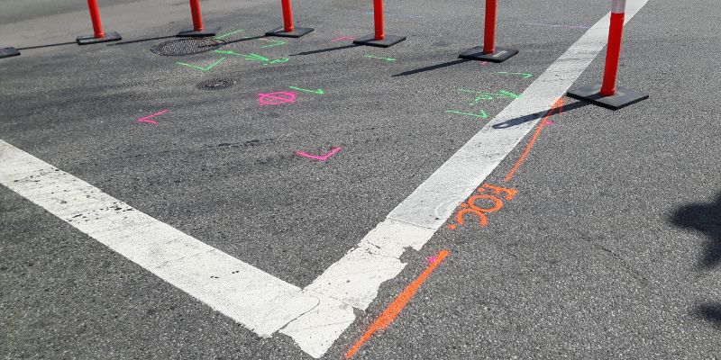
GPR utility locating can provide additional subsurface information before excavation begins. Instead of relying entirely on assumptions or outdated drawings, project teams can use field data to develop a better understanding of what may be present underground.
GPR data can also help identify unexpected features. Multiple scans across an area can reveal patterns that provide information about the lateral position and orientation of subsurface objects. FHWA notes that analyzing multiple scans is important for developing confidence in the location and orientation of a buried utility.
However, GPR should not be treated as a guarantee that every underground utility will be detected. Soil conditions, depth, moisture, clay content, utility material, congestion, and other factors can affect performance.
For that reason, GPR is most effective when incorporated into a comprehensive utility locating process rather than being treated as the only source of underground information.
6. Combining GPR With Other Utility Locating Methods
Although GPR is a powerful technology, the best underground utility investigations often involve multiple methods.
Electromagnetic locating equipment can be highly effective for tracing conductive utilities. GPR can complement that approach by investigating nonconductive materials and providing additional subsurface information.
Using multiple technologies can help professionals compare findings and build a more complete picture of underground conditions.
Depending on the project, a utility investigation may involve:
Ground penetrating radar
Electromagnetic locating
Existing utility records
Surface markings
GPS or mapping technology
Survey information
Test holes or potholing
Vacuum excavation
Field verification
The FHWA describes GPR as a complementary tool rather than a stand-alone solution for every utility locating situation.
This approach is especially important on complex sites where utilities may be closely spaced, undocumented, abandoned, or constructed from different materials.
At On The Mark Locators, combining professional experience with appropriate locating technologies can help create a more informed understanding of subsurface conditions before ground disturbance begins.
Benefits of Professional GPR Utility Locating
When properly planned and performed, GPR utility locating can provide several important benefits for construction and infrastructure projects.
Better Underground Awareness
GPR can provide information about buried features that may not be visible from the surface. This gives project teams a better understanding of potential underground obstacles.
Non-Destructive Investigation
Because scanning is performed from the surface, GPR can investigate an area without immediately requiring excavation.
Detection of Nonmetallic Features
GPR can help locate certain nonconductive utilities that may be difficult to identify using electromagnetic locating alone.
Improved Project Planning
Knowing more about underground conditions before excavation can help contractors plan work areas, excavation routes, and other construction activities more effectively.
Reduced Risk of Utility Damage
Better information about buried infrastructure can help reduce the likelihood of accidental utility strikes, although no locating technology can eliminate risk completely.
Potential Cost Savings
Avoiding utility damage can help prevent unexpected repair costs, service interruptions, work stoppages, and project delays. The Envirosight reference article similarly identifies protection of underground assets and prevention of damage as key benefits of utility locating.
Understanding the Limitations of GPR
While GPR scanning can be extremely useful, it is important to understand that results are influenced by site conditions.
Ground penetrating radar generally performs better in materials where radar signals can travel effectively. Highly conductive materials such as certain clay-rich or saturated soils can significantly reduce signal penetration. Moisture, soil composition, depth, surface conditions, and underground congestion can all affect data quality.
There is also a balance between penetration depth and resolution. Higher-frequency signals can provide more detailed information at shallower depths, while lower-frequency signals can offer greater penetration with lower resolution.
Another important consideration is interpretation. A radar response does not automatically identify an object with absolute certainty. A trained professional must analyze the data, compare patterns across scans, and consider the site conditions.
For these reasons, professional experience is just as important as the equipment being used.
Conclusion
Underground utilities are essential to modern communities and properties, but their hidden location can create significant challenges for construction, excavation, drilling, and infrastructure work. Before disturbing the ground, understanding what may be below the surface is an important step toward safer and more efficient project planning.
GPR utility locating provides a non-invasive way to investigate subsurface conditions using electromagnetic radar signals. Its ability to identify certain conductive and nonconductive underground features makes it a valuable addition to traditional locating methods. GPR scanning can also provide useful information about the location, orientation, and approximate depth of subsurface anomalies when site conditions allow.
However, successful locating depends on more than technology alone. Equipment selection, site conditions, scanning patterns, data interpretation, and professional experience all contribute to reliable results. GPR is generally most valuable when combined with other locating techniques and appropriate field verification.
For contractors, engineers, property owners, and project managers who need better information before excavation, ground penetrating radar for utility locating can provide an important layer of subsurface visibility.
On The Mark Locators can help project teams take a proactive approach to underground utility detection by using appropriate locating technology and professional field expertise. With better knowledge of what is beneath the surface, teams can make more informed decisions, improve planning, and reduce the risks associated with unexpected underground infrastructure.