Excavation involves digging and drilling the ground to install new pipelines, cables, and other infrastructure. But before any digging can begin, it is essential to locate all the underground utilities’ exact locations to avoid accidents or damage to the existing infrastructure. This is where underground utility locating comes in.
Conducting a site survey is the first step in our underground utility locating process. Our team visits the excavation site to assess the area’s conditions and gather information about the underground utilities that need to be located. This includes reviewing the available utility plans and contacting the local utility companies to determine the location of their infrastructure. The site survey helps us identify potential hazards, such as buried tanks or hazardous materials, and plan our utility locating strategy accordingly.
Once we have gathered all the necessary information about the excavation site, we start our underground utility locating process using electromagnetic induction. This technology works by detecting the electromagnetic fields generated by underground utilities. Our team uses a specialized transmitter tool to send an electromagnetic signal into the ground. The signal is then detected by a receiver, which helps us determine the location and depth of the underground utilities.
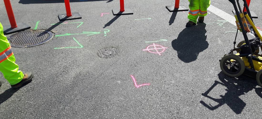
In some cases, electromagnetic induction may not be enough to locate underground utilities accurately. This is where ground penetrating radar (GPR) comes in. GPR is a non-destructive testing method that uses radar pulses to create an image of the subsurface. Our team uses GPR to detect underground utilities made of non-conductive materials, such as plastic or concrete. GPR is also useful in identifying any voids or cavities beneath the surface, which could indicate potential hazards.
Once we have identified the locations and depths of the underground utilities, we mark them on the ground using specialized paint or flags. We use different colors to distinguish between different types of utilities, such as water, gas, or electricity. This helps the excavation team avoid accidentally digging into the wrong utility and causing damage.
After marking the utility locations, we provide a utility report to the excavation team. The utility report includes detailed information about each underground utility’s location, depth, and type. This report helps the excavation team plan their work and avoid potential hazards. Obtaining the necessary permits and approvals from local authorities is also essential.